Our Clients
Jishna Geo Tech Solutions connects industries through precision and efficiency. Our advanced technology and skilled team enable us to meet the evolving needs of our clients while upholding the highest standards of performance. We are dedicated to sustainable growth, ethical business practices, and fostering long-lasting partnerships that yield shared success in every geological aspect. At Jishna, we are committed to shaping a future where progress, responsibility, and compassion coexist seamlessly.
Groundwater investigation refers to the process of studying and analyzing underground water sources to determine their quantity, quality, and distribution.
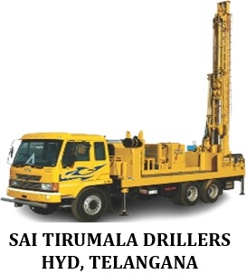
DTH (Down-the-Hole) drilling and rotary drilling are two common methods used for drilling boreholes. DTH drilling uses a hammer located at the drill bit to deliver high-impact force
Exploratory tests such as APT (Aquifer Performance Test), SDT (Step Drawdown Test), PYT (Primary Yield Test), and Slug Test are essential procedures conducted on Exploration Wells (EW) and Observation Wells (OW) to evaluate.
Geophysical surveys such as ERT (Electrical Resistivity Tomography), SRT (Seismic Refraction Test), and Electrical Resistivity Survey are non-invasive techniques used to investigate subsurface geological formations.
Geophysical logging and interpretation involve measuring and recording the physical properties of subsurface materials to gather information about underground formations.
Mineral exploration is the process of searching for and identifying valuable mineral deposits beneath the Earth's surface. This involves a series of techniques such as geological surveys, drilling
Mining involves the extraction of valuable minerals and other geological materials from the Earth’s crust. It is a crucial industry that provides raw materials for various sectors
Core drilling is a method used in the exploration and evaluation of mineral deposits, which involves extracting cylindrical samples of rock, known as "core," from the Earth. This technique provides valuable
Soil testing is a process used to analyze the physical, chemical, and biological properties of soil in order to understand its suitability for various applications, such as agriculture, construction
Drone survey and mapping is a modern technique that utilizes unmanned aerial vehicles (UAVs) equipped with cameras, sensors, and GPS technology to capture high-resolution aerial imagery
Geographic Information Systems (GIS) is a powerful technology used to capture, store, analyze, manage, and visualize spatial or geographic data. It combines hardware, software, and data
Water quality analysis is the process of testing and evaluating the physical, chemical, and biological characteristics of water to assess its suitability for various uses
DGPS (Differential GPS) is a high-precision positioning technique used in geological surveys to enhance the accuracy of standard GPS data. By correcting satellite signal errors through a reference station.
Geological mapping is a fundamental tool in earth science used to document and interpret the distribution, nature, and relationships of rock units and geological structures at the surface or subsurface.


